Nōmaku sanmanda bodanan baku
〒771-1506 徳島県阿波市土成町土成田中198−2
👁️ Street View in front of the temple 🧭 Directions with Google Maps (to the temple gate) 🚗 By car: to the car park 📍 Open in a map app
Temple map
Buildings found in OpenStreetMap. Faded: uncertain position. The map may be incomplete: a building missing here may still exist on site. See the temple in Google Maps ↗
Blue: trail from the previous temple · red: to the next temple · 🛖: henro goya (hut). Tap a trail to open Street View at that spot.
🚗 To temple 10 Kirihata-ji : 4.7 km · 15 min by car
Pilgrims’ trail from OpenStreetMap; walking time computed from the terrain, plus half for breaks.
🗺️ All the stages at a glance: on foot or by public transport →
History
From a mountain site to a temple on the plain
The temples’ association places the old Hōrin-ji in a valley about four kilometres to the north, where foundation stones and burnt earth remain. It links these remains to the destruction of 1582, then dates the move to the present site and the rebuilding to the Shōhō era, between 1644 and 1648. Another fire destroyed the buildings in 1859, except the bell tower; the present buildings were raised again in the Meiji era. According to the local account, the fire broke out while villagers were rehearsing a jōruri play.
The reclining Buddha and the white snake
The memory of the white snake is said to survive in the old name Byakudazan Hōrin-ji, handed down by local tradition. The founding tradition goes back to 815: Kōbō Daishi is said to have seen a white snake, taken as a messenger of the Buddha, then carved an image of Shaka entering nirvāṇa. This figure, lying on its right side and surrounded by mourning disciples and animals, remains at the heart of the temple’s worship.
Description
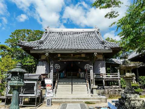
Photo : Naokijp, CC BY-SA 4.0, Wikimedia Commons
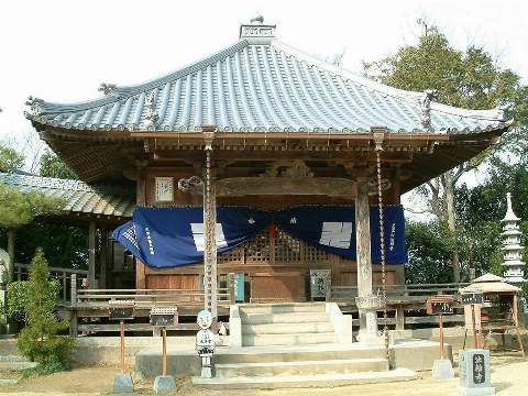
Photo : Dokudami, CC BY-SA 4.0, Wikimedia Commons