🔍
🚧 Translation in progress: this page is shown in French for now. Version française

← The whole glossary

Michishirube

Waymarker showing the path; also the title of the oldest surviving pilgrimage guide

PilgrimageHistorynew, to be validated
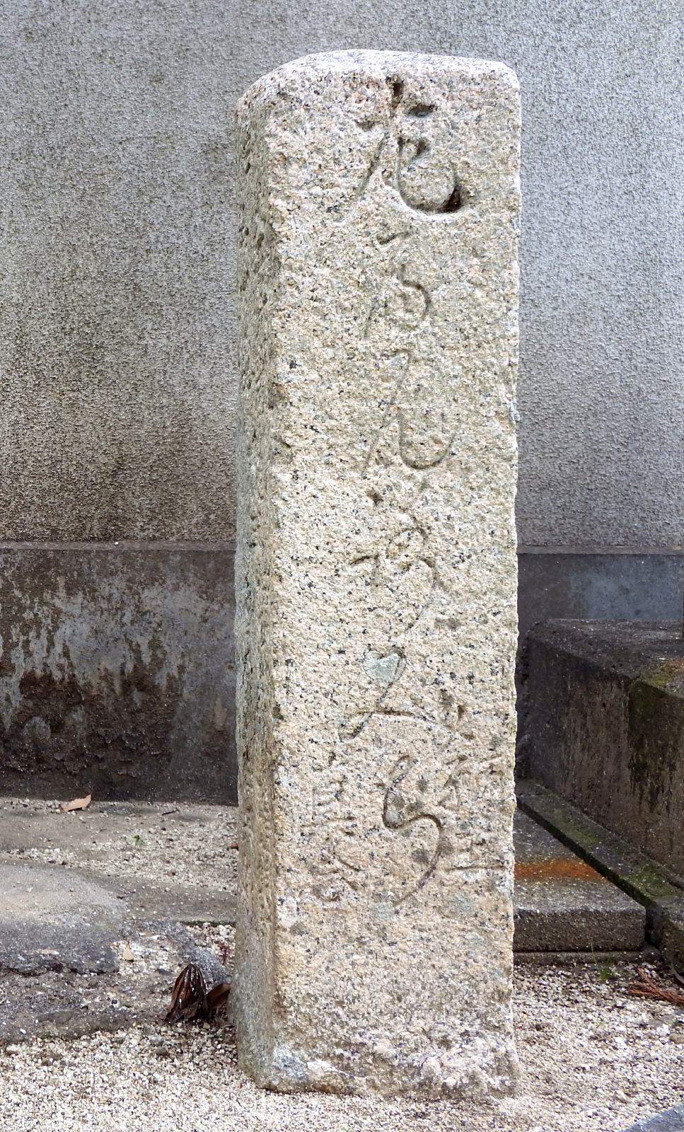
Une borne de Shinnen (真念の遍路石), fin du XVIIe siècle : l’inscription est gravée en écriture cursive.
Une borne de Shinnen (真念の遍路石), fin du XVIIe siècle : l’inscription est gravée en écriture cursive.Photo : Dokudami, CC BY-SA 4.0, via Wikimedia Commons
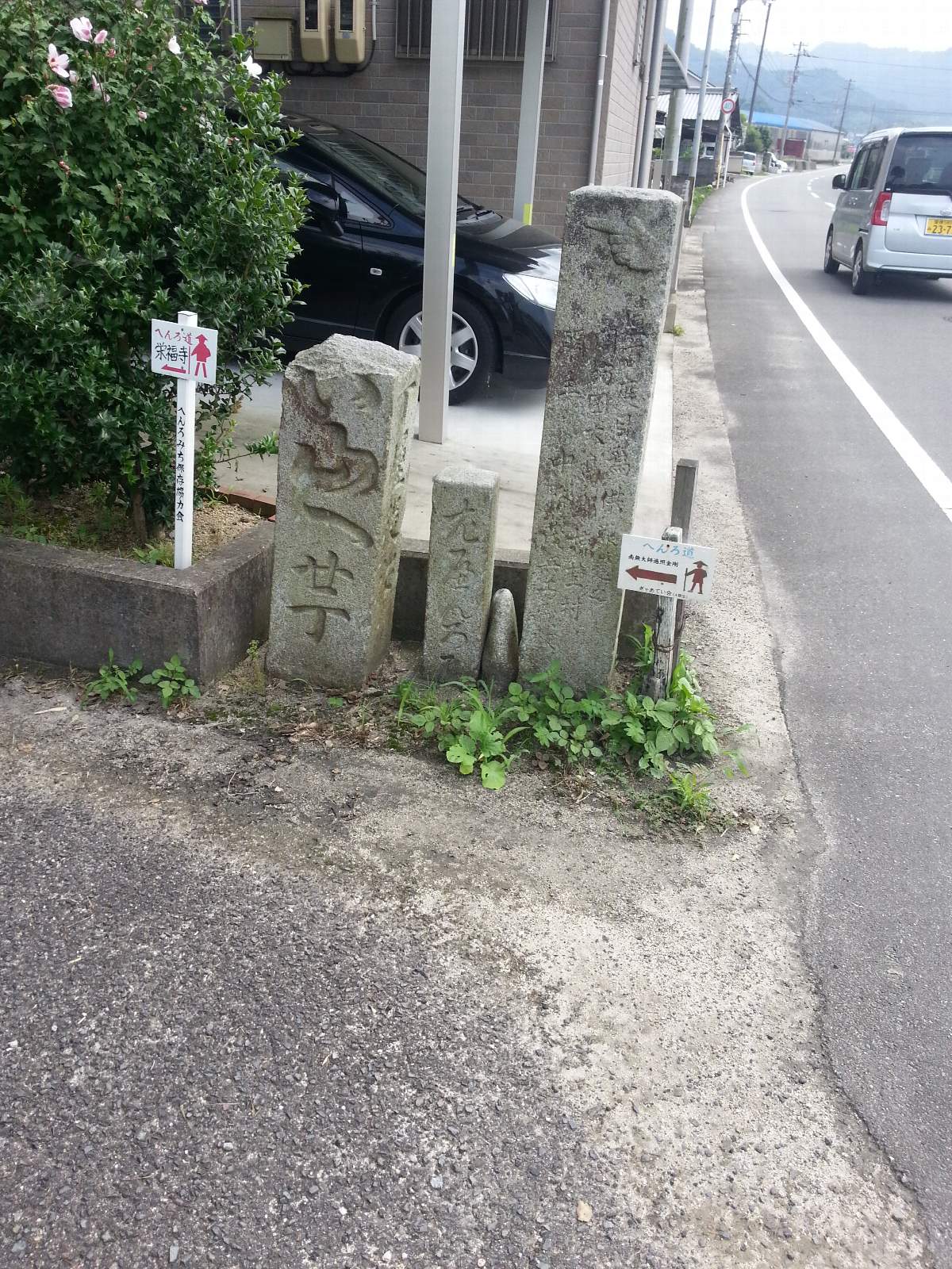
Trois bornes au même carrefour, près du pont Otabisho, sur le chemin du temple 57 : à droite, celle de Nakatsukasa Mohei posée lors de son 100e pèlerinage, avec sa main qui pointe ; à gauche, une borne à poème qui indique le temple 58 à 20 chō ; au milieu, une petite borne en écriture cursive, dans le style de celles de Shinnen.
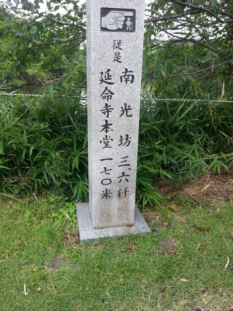
La main qui pointe : « 従是 延命寺本堂 一七〇米 », d’ici 170 m jusqu’au hondō d’Enmei-ji (temple 54) ; le temple 55 Nankōbō à 3,6 km.
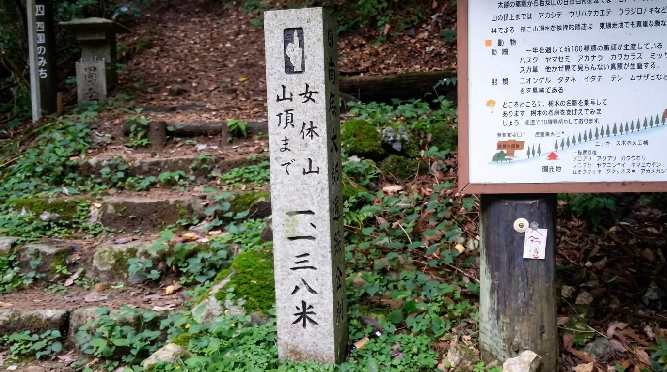
Au pied du Nyotai-san, avant le temple 88 : 1 138 m jusqu’au sommet, avec la main qui pointe (photo améliorée).
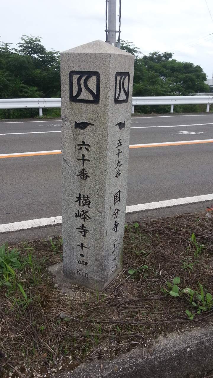
Borne moderne en granit : temple 60 Yokomine-ji à 10,4 km d’un côté, temple 59 Kokubun-ji de l’autre.
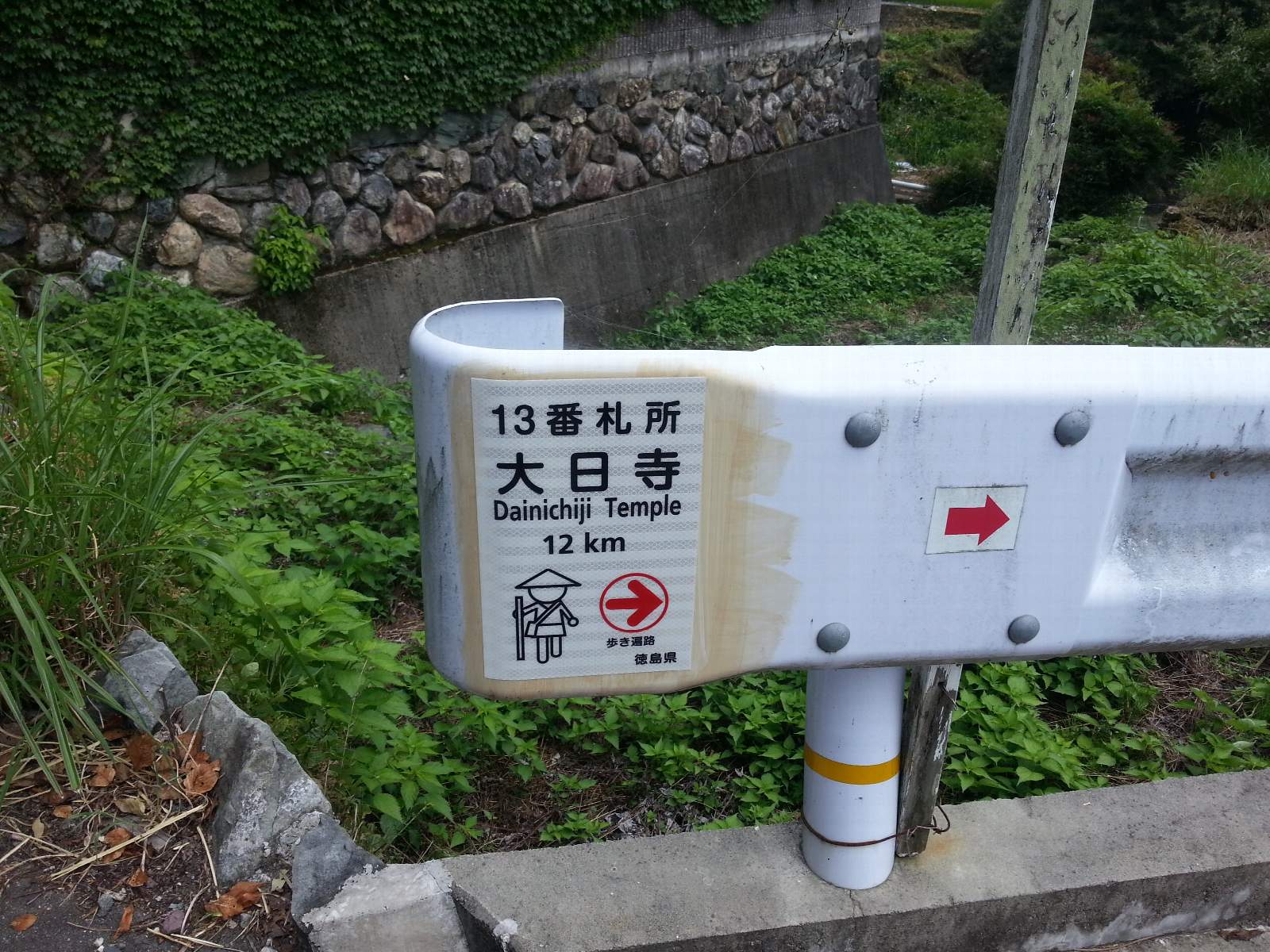
Plaque de la préfecture de Tokushima pour les marcheurs (歩き遍路) : temple 13 Dainichi-ji à 12 km.
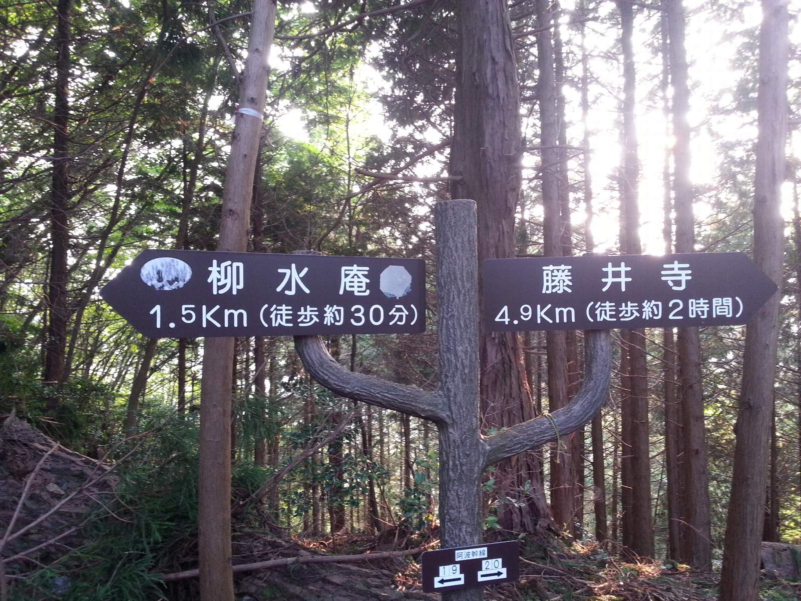
Sur le chemin de montagne entre les temples 11 et 12 : Ryūsui-an à 1,5 km, Fujii-dera à 4,9 km.

Michishirube (道標 or 道しるべ, “what shows the way”) refers to the markers and signs that guide the walker. The word has a second meaning: it is the title of the oldest surviving pilgrimage guidebook, the Shikoku henro michishirube (四国遍路道指南), published in 1687 by Shinnen. Read the Chinese way, 道標 is also pronounced dōhyō.

Along the route you will meet several kinds of michishirube:

  • Shinnen’s markers (late 17th century): engraved stones showing the direction of the next temple, sometimes with a carved hand, and the donor’s name. A text of 1690 speaks of about two hundred markers; fewer than forty are identified today.
  • The markers of Nakatsukasa Mohei (late 19th and early 20th century), often decorated with a hand pointing the way.
  • Chōishi (丁石): small stones counting down the distance to the temple in chō (about 109 m), mostly on climbs.
  • Modern signs: boards, small plates and red “へんろみち” arrows put up by associations and volunteers. These are what guide walkers today.

See also hyōseki (標石, engraved stones) and, for the history, Shinnen, his guide and his markers and the 1687 guide.

In English
Signpost, waymarker; also a guidebook
Other spellings
michi shirube · dōhyō · 道しるべ · 道標

In the same category

Aruki Henro Bangai Bekkaku Chōsokabe Motochika Daishidō Dōgyō Ninin Kamakura period Fudasho Gohōgō Goshuin Gyaku uchi Henro Henro Goya Henro korogashi Henro michi Hyōseki Ikkoku Mairi Jun-uchi Junrei Kechigan Kokubun-ji Kōya-san Kugiri-uchi Kukai Namu Daishi Henjo Kongo Nojuku Nōkyō Nōkyō-chō O-settai Ohenro-san Orei-Mairi Osamefuda Sanmon Sendatsu Settai Shingon Shukubō Tōshi-uchi Tsūyadō Yūben Shinnen